September 8, 2023
This summer, NOAA Air Resources Laboratory (ARL) researchers joined together with experts from numerous other institutions and federal agencies to investigate the causes of poor air quality. Their research campaign will investigate not only anthropogenic, or human caused emissions, but also biological sources of emissions that alter the atmospheric chemistry and composition and impact air quality and climate over North America.
The Atmospheric Emissions and Reactions Observed from Megacities to Marine Areas campaign, known as AEROMMA, combines almost every possible instrument and platform in NOAA’s toolkit to examine emissions across various regions of the United States: from satellites, to airborne, ground, and mobile platforms, the campaign will provide emerging research into urban air quality, atmospheric interactions at the marine-urban interface, marine emissions, satellite-based observations of atmospheric composition, and climate change. A number of sources factor into poor air quality in urban areas, ranging from biological sources to consumer and industrial products as well as fossil fuels for cars and transportation. Ozone, another significant contributor to poor air quality, had been trending downward from 2000-2014.
“This campaign is essential to help understand the many causes of poor air quality in the US. A variety of platforms deployed in different landscapes will help us to better understand air pollution at a nationwide level and to provide means to improve our capabilities to forecast air quality,” said Dr. Ariel Stein, Director of NOAA’s Air Resources Laboratory. “ARL’s instrumentation and efforts are focused on the northeast corridor, in urban areas in particular, from DC through New York, where air pollution has been a stubborn problem.”
Urban air quality is a unique problem for each city, but New York City and Long Island Sound are the focus of the Northeastern Air Quality portion of the AEROMMA investigation. Previous studies have demonstrated the unique geography of Long Island Sound contributes to the poor air quality north east of NYC. But there is still a lot to learn about the region’s air quality challenges. Recent research indicates that building exhaust, industrial chemicals and personal care products contribute to volatile organic compounds (VOCs), which is a poorly understood source of urban air pollution. Determining the contribution of VOCs, biological sources, and fossil fuels to air pollution is one larger goal of the AEROMMA studies.
Ground stations: NYC-METS
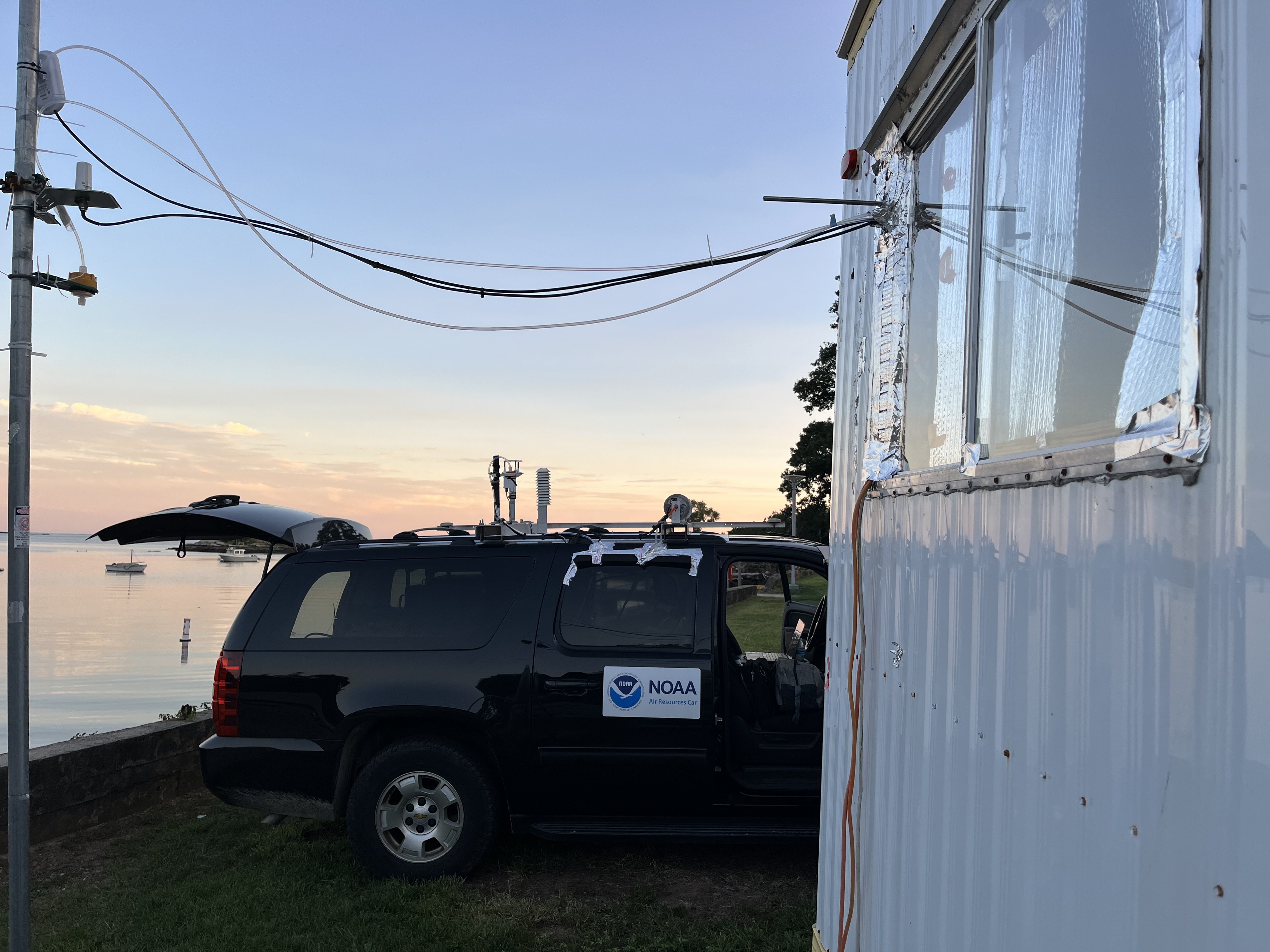
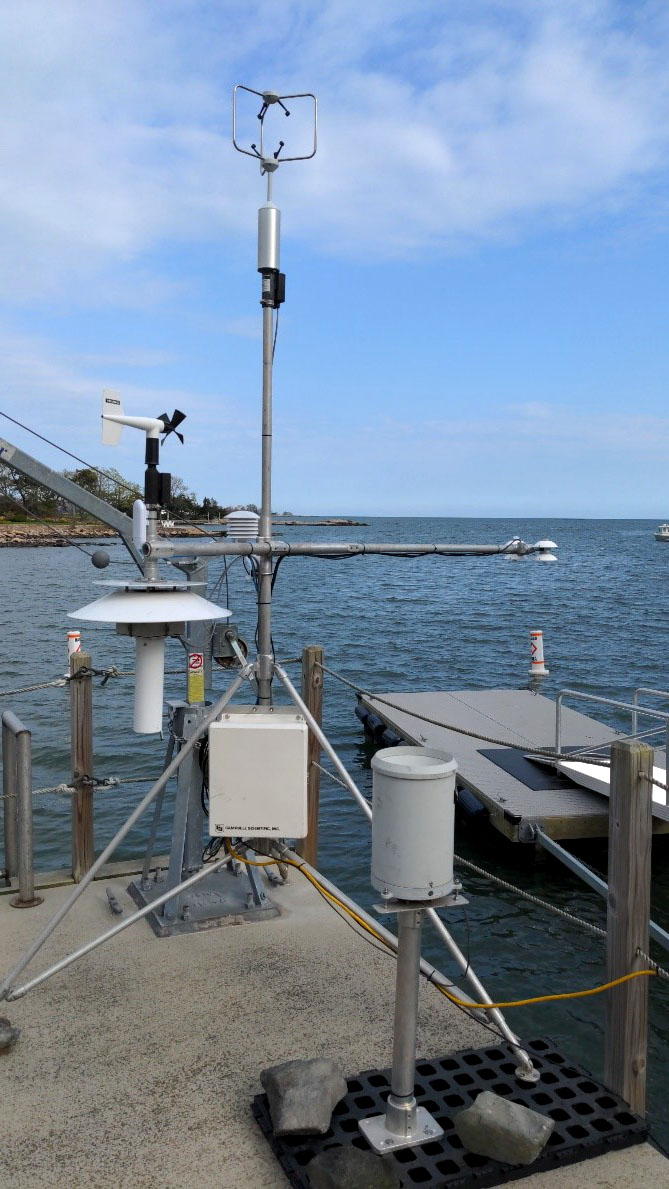
ARL’s Dr. Nebila Lichiheb, in collaboration with Yale University, Princeton University and NOAA’s Climate Program Office, have set up instrumentation to measure marine area atmospheric ammonia (NH3) concentrations at the Yale Coastal Field Station (YCFS) in Guilford, CT as part of the New York City metropolitan Measurements of Emissions and TransformationS (NYC-METS) study. The study runs from spring through fall and will lead to a better understanding of the seasonal variability of ammonia concentrations over a coastal ecosystem.
One variant of nitrogen, namely ammonia, plays a key role in ecosystems. Ammonia is not only toxic to aquatic animals. But it also plays an important role in the formation of the aerosols which can form the particles of air pollution which can adversely affect human health.
On the Road
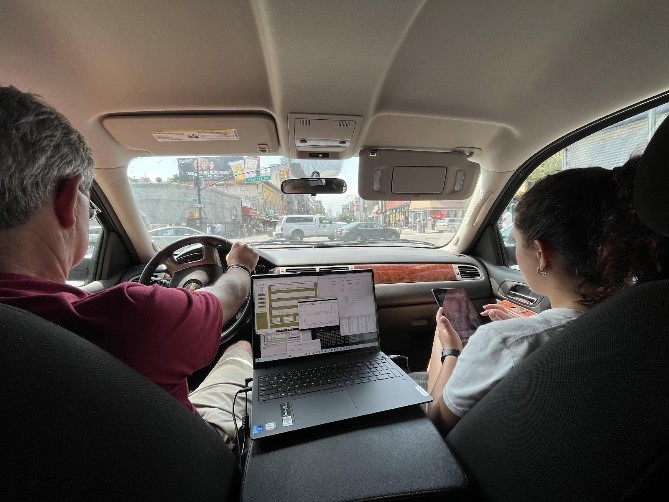
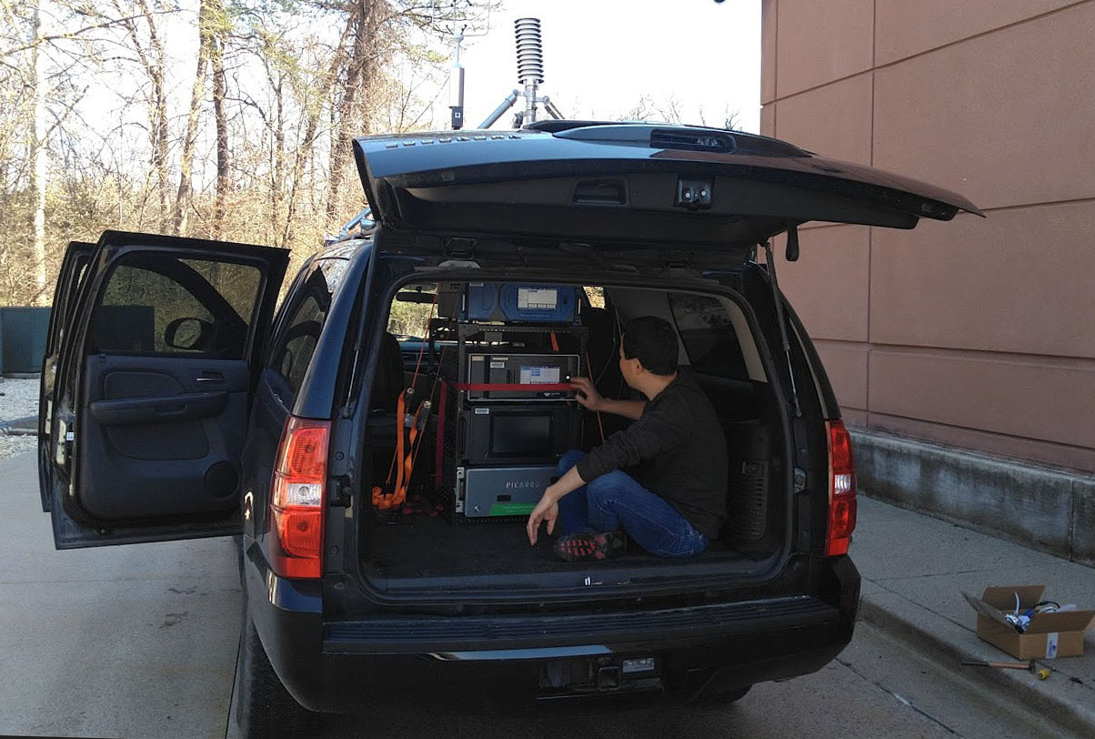
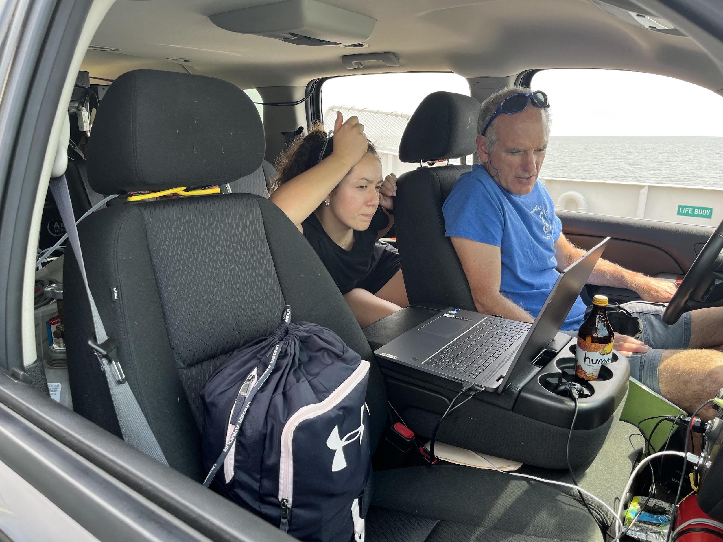
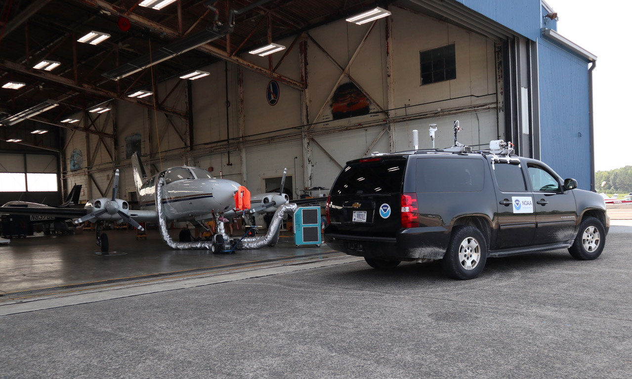
ARL’s Dr. Xinrong Ren has spent many hours in NYC traffic, all for the goal of improving research. He and Phil Stratton take turns driving the Air Resources Car, or ARC, through NYC streets to determine emissions and sources of greenhouse gases, such as Methane, CO2 and air pollutants such as Ozone, Black Carbon and other particulate matter. Methane (CH4) is among the most potent of greenhouse gasses (GHGs) and one of the most controllable. Identifying sources of methane is critical to reducing these emissions.
The ARC can identify major point emission sources of methane and other greenhouse gases from landfills, wastewater treatment plants, and natural gas compression stations. These hyperlocal measurements of greenhouse gases and air pollutants can help to address environmental justice issues. The ARC has been driven extensively through Baltimore, MD and Washington, DC and has located numerous neighborhoods with anomalously high pollution concentrations.
And in the Skies
The final element in the ARL campaign are flights coordinated with the ARC and the University of Maryland (UMD) fully instrumented Cessna 402 research aircraft. The UMD Cessna has been operating in the northeast corridor of the U.S. from Washington, DC to New York City for the last few summers. Since 2019, the Cessna has been flying to collect datasets similar to that of the ARC, but over a wider region of the Northeast Corridor. A better understanding of the meteorology and chemistry leading to air pollution events and over this region can provide the scientific basis for effective air quality and climate policies.
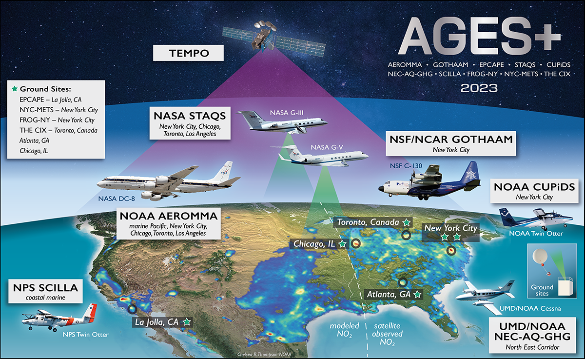
The Cessna is just one of a large fleet of aircraft participating in this investigation. AEROMMA is organized and led by NOAA’s Chemical Sciences Laboratory and is NOAA’s flagship field campaign within the larger, nationwide AGES+ effort this summer. AGES+ includes a number of academic and government partners — NASA, NIST, EPA and NSF — with instruments ranging from backpack and rooftop sensors to coordinated satellite observations.
