Particle Dispersion Example |
|||
 Previous |
 Next |
|
|
In order to take a single or a few individual particle trajectories to the next step of defining the air concentration, we can start by looking at the particle distribution at a particular time after the release of many particles.
|
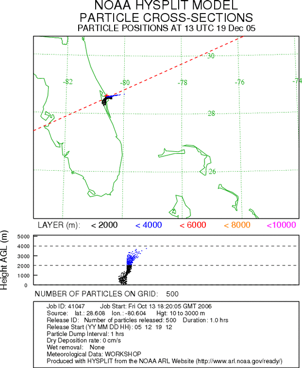
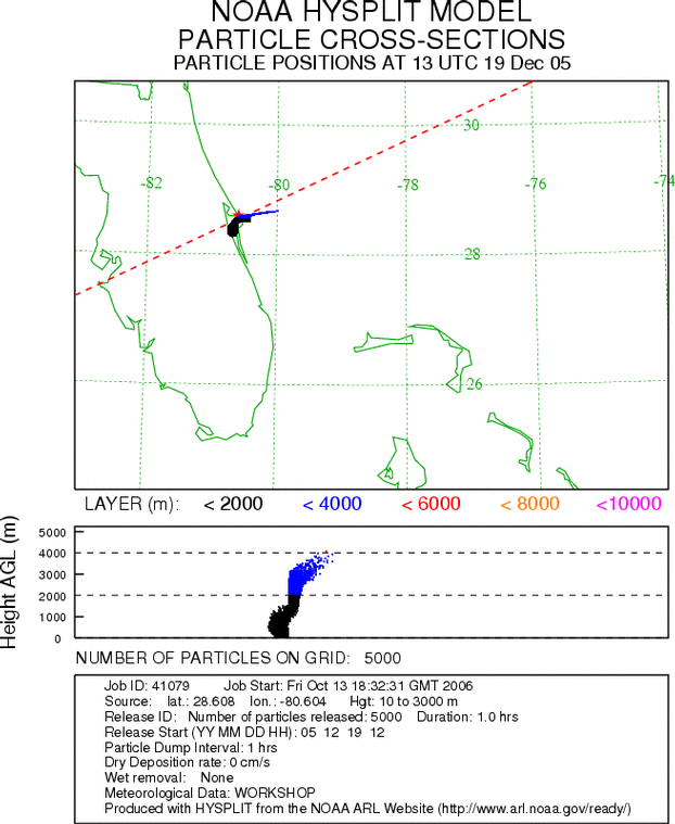
For this example see Example 10 Powerpoint (Ex10_hysplit.ppt) or, from the Dispersion Model main menu click on the link Compute particle dispersion and choose the NAM 12 km data set from the WORKSHOP archive listing. Set the source location to the same Florida location as the Google Earth example (28.608N, 80.604W) with a release layer between 10 and 3000 MAGL (the depth of the 3 trajectories calculated previously). Next, set the number of particles to be released per emission cycle to 500, which is the usually the minimum number one should run with, and the number of hours to release them to 1 hour. Finally, set the total run time to 9 hours and the particle dump interval to 1 hour, which will produce snapshots of the particle positions every hour. |
|
The result (lower left) for hour 3 shows the particles moving away from the source to the east at the higher levels and toward the southwest at the lower levels, as was expected based on the 3 trajectories computed earlier. Click on the image to display a loop of the particle positions at each hour of the 9 hour simulation. Notice how the particles become few and far between with time. Next, rerun the same case (use the browser's Back button since this page does not have the rerun option available at this time), however increase the number of particles to 5000. The result (lower right) shows the same pattern, but with many more particles helping to define the plume shape. Again, click on the image to see the loop.
|
|
Previous |
Next |