US Climate Reference Network

Changes in the climate can influence economic prosperity, national security, and human and environmental health. Businesses, citizens, communities, governments, and international organizations need accurate and high quality meteorological observations and forecasts to assess and adapt to current and potential threats associated with climate variability.

ARL has a long-term partnership with the NOAA National Centers for Environmental Information (NCEI) to operate and maintain the U.S. Climate Reference Network (USCRN). This network provides long-term robust observations necessary to document climate trends for the United States. The USCRN provides high quality, reference-grade measurements of critical climate measures such as air temperature, precipitation, winds, land surface temperature and solar radiation. ARL’s activities focus on:

  • advancing the quality and quantity of reference observations;
  • evaluating select observing systems for their ability to satisfy ongoing and evolving climate requirements;
  • improving the understanding of air-surface interactions; and
  • analyzing long-term observational datasets and models to understand climate variability and change.

ARL manages, operates and maintains USCRN’s 143 stations, which includes 143 stations in the lower 48 (114); Alaska (25); Hawaii (2), and (2) in Canada. These stations provide long-term robust climate observations necessary to document climate trends in the U.S. The network is now entering its third decade of service, having begun initial operations in 2002.

Researchers at ARL’s Atmospheric Transport and Diffusion Division install and provide extensive evaluations and maintenance of the instruments and infrastructure for the USCRN. Additionally, ARL conducts energy, water and greenhouse gas flux measurements and analyzes their relationships. A predictive understanding of the surface energy budget and related feedbacks is critical to the understanding of climate forcing factors at the land surface and the ability to credibly predict future conditions, especially those related to water resources.

Wood fencing obscures an instrument on top of a mountain
Close-up of a USCRN station's precipitation gauge and wind shield. Credit: NOAA
U.S. Climate Reference Network (USCRN) records an all-time USCRN maximum temperature was set on Sunday July 11, 2021 at the station in Stovepipe Wells, CA with a record of 128.6°Fahrenheit; that coupled with the highest ever daily minimum temperature recorded in North America of 107.7°F (and second most globally), resulted in the highest ever average daily temperature ever observed on the planet of 118.1°F as depicted in the hourly temperature profile,

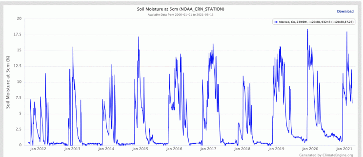
Soil Moisture

Ten year range of soil moisture measurements for Merced, CA, as captured by USCRN data.

Soil moisture is a critical land surface variable impacting a range of climatological, agricultural and hydrological processes. Soil moisture observations can forewarn of impending drought or flood conditions before other more standard indicators are triggered. These measurements are useful for applications ranging from agricultural monitoring to weather prediction, and from drought to flood forecasting.

ARL soil moisture data  is available on the USCRN website as well as through the US Drought Portal. The portal is hosted by NOAA’s National Integrated Drought Information System (NIDIS) under the National Coordinated Soil Moisture Monitoring Network. The network was designed to integrate soil moisture data from sources across federal and state in-situ networks, such as USCRN, remote sensing data and other modeling capabilities.

Since 2008, NIDIS, ARL and the National Centers for Environmental Information (NCEI) have collaborated to install and manage the soil moisture sensors and data acquisition integration, data ingest and quality control for soil observations at 11 out of the 114 sites in the continental U.S.

Soil moisture information is critical for weather and climate, runoff potential, flood control, soil erosion, prediction of crop yields, and reservoir management. Soil moisture plays an important role in the development of weather patterns and the production of precipitation. While there are other soil moisture networks, the USCRN is the only ground-based soil moisture network that spans the contiguous U.S. with a distribution of stations in nearly all the topographical, vegetative and climatic environments of the country.

USCRN Stations

ARL designs, evaluates and maintains the array of instruments and the USCRN infrastructure to provide a reference-grade benchmark observing system for the next 50-100 years. As a key participant in climate observing networks, both nationally and internationally, ARL develops methods for measuring climate parameters with high accuracy and reliability.

In a collaboration with NCEI, ARL researchers provide the overall management, engineering design and measurement capabilities and expertise for operating the USCRN stations. This includes deployment and maintenance of the sites and regular calibration of the sensors. ARL also provides analysis of emerging sensor technologies for future applications. The near real-time and long-term archived data for all sites are served to the public by NCEI. USCRN’s most unique feature is a triple sensor redundancy for air temperature, precipitation, and soil moisture and temperature, which is key in producing the highest quality climate data possible.

Each station is strategically placed away from urban and suburban influences to avoid any possible locally-induced biases in the record. All of the stations in the contiguous U.S. are equipped with air temperature, precipitation, relative humidity and soil moisture and temperature sensors The one exception being Torrey Canyon, Utah as it is built on solid rock. Soil sensors are installed in the Kenai, AK station, with research continuing on possibly extending these measurements into a more unique permafrost environment. Additionally, there are ancillary sensors measuring wind speed, solar radiation, ground temperature, and wetness to assist with the quality control of the primary air temperature and precipitation variables.

References 

For information about the status and assessment of the USCRN after 10 years of operation:

Diamond, H.J., T.R. Karl, M.A. Palecki, C.B. Baker, J.E. Bell, R.D. Leeper, D.R. Easterling, J.H. Lawrimore, T.P. Meyers, M.R. Helfert, G. Goodge, and P.W. Thorne, 2013: U.S. Climate Reference Network after one decade of operations: status and assessment. Bull. Amer. Meteor. Soc., 94(4); doi: 10.1175/BAMS-D-12-00170

USCRN data sets on the NCEI website.

Contact

Howard J. Diamond, PhD – USCRN Program Manager
Email: howard.diamond@noaa.gov

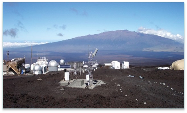
Station instruments on top of the mountain
USCRN station on Mauna Loa, Hawaii. Credit: NOAA
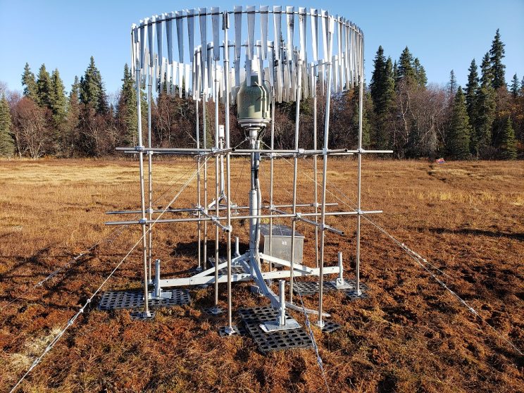
A metal grid structure surrounds a thin metal post, on top of which sits what looks like a metal bucket with a tapered top. Long, thin strips of metal hang in two circles, one inside the other, at the top of the structure, which is tethered to the ground by metal cables.
Rain gauge at a USCRN station. Credit: NOAA
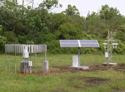
Three pieces of monitoring equipment in a field
USCRN equipment at the University of Hawaii site in Hilo. Credit: NOAA Earth System Research Laboratory Global Monitoring Division