Meteorological Instrumentation & Mesonet Operations
ARL maintains a number of mesonets, or weather networks. ARL’s Special Operations Research Division (SORD) has continuously observed and recorded meteorological conditions at the Idaho National Laboratory (INL) and its environs since it first opened in 1948. The Idaho mesonet consists of 34-stations remotely managed in the INL MESOscale meteorological monitoring NETwork (Mesonet).
The network includes carefully selected advanced hardware and software, meteorological towers, radio telemetry, a radar wind profiler and radio acoustic sounding system, and a system that measures the exchange of water vapor and carbon dioxide between the Earth’s surface and the atmosphere. A coordinated remote collection of these sensor data are conducted in order to obtain a high quality representation of the environment. Temporary mesonets are used in support of short-term experiments and studies, while permanent mesonets are used for long-term support of regulated facilities and for climate studies.
SORD-ID’s science helps advance the understanding of processes occurring in the atmospheric boundary layer. Through meteorological data collection and analysis, and weather prediction and surveillance, SORD-ID supports INL Emergency Management, Environmental Compliance, and Site Operations to determine appropriate emergency actions, policy responses, and safety alerts. At the local level, SORD-ID’s science specifically helps to ensure the safety of INL personnel and neighboring residents.
The NOAA/INL Mesonet began with a single station at the Central Facilities Area (CFA) in 1949 on what is now known as the Idaho National Laboratory (INL). Between 1950-1970, six on-site and 16 off-site monitoring stations were added to form an expanded observational network. The number of meteorological monitoring stations continued to expand and change over the years not only to support various projects and provide meteorological data for emergency response models, but also to gain a better understanding of the climatology of the INL and Eastern Snake River Plain. The current configuration of the Mesonet meets the needs of INL planners, emergency managers, scientists, engineers, operations personnel, the local National Weather Service (NWS) Weather Forecast Office (WFO) in Pocatello, ID, and the general public.

Meteorological Mesonet Tower Credit: NOAA
Mesonet facilities and instrumentation
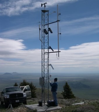
Of the 34 fully automated meteorological observation stations in operation at the INL and surrounding area, 13 are located within the boundaries of the INL. The remaining stations are sited at key locations throughout the Eastern Snake River Plain. Standard meteorological parameters are measured at each Mesonet station. All station information, instrument height, and types of data being collected at each level is available.
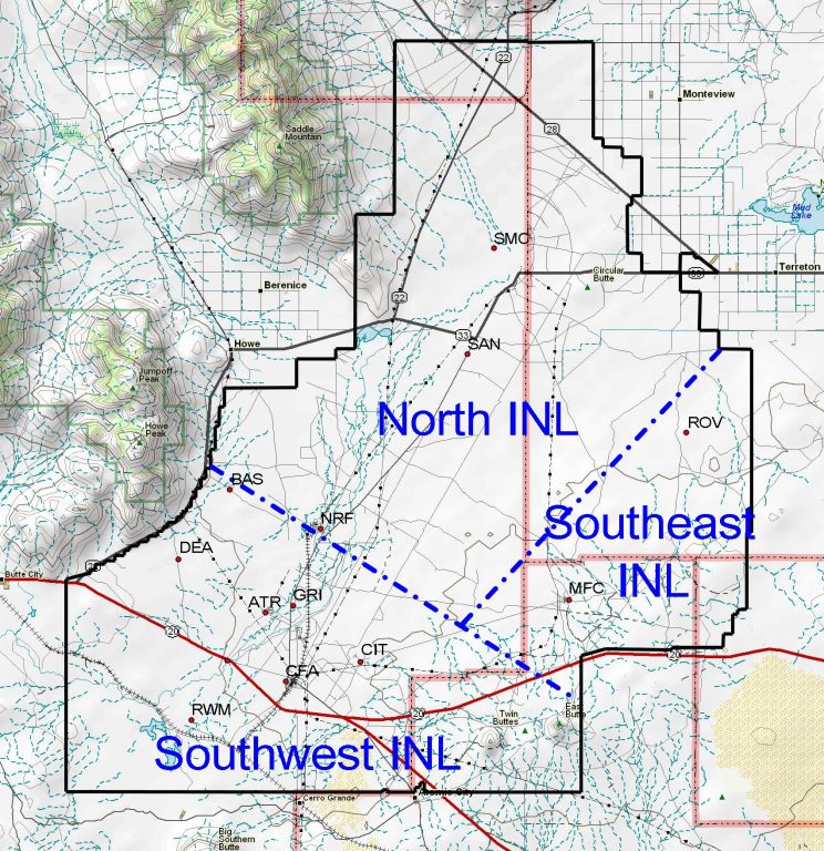
INL designated microclimate zones in Idaho.
Most of the towers are 50 ft. tall; taller towers range in height from 150 to 250 ft. and are the “primary” on-site observation stations in each of the three INL microclimate zones depicted in the image to the right. These towers are at Grid 3/INTEC (GRI), MFC, and SMC. Shorter towers are on the summit of Big Southern Butte and Craters of the Moon National Park where aesthetic restrictions permit only a 20 ft. and 30 ft. tower, respectively.
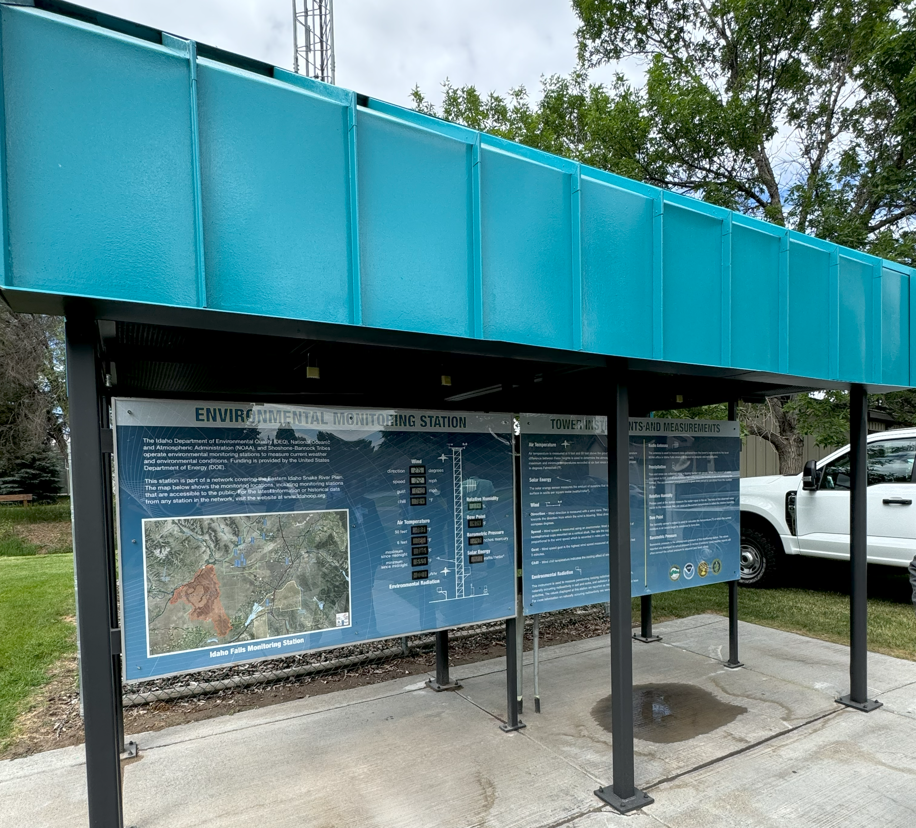
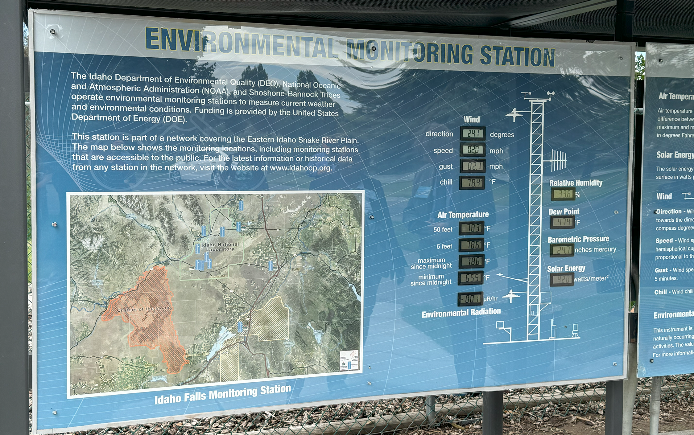
A map of the NOAA/INL Mesonet stations is below. Several of the stations, called Community Monitoring Stations (CMS), are sited at schools and other places frequented by the public to enhance relations with the local communities. The CMS stations were developed in partnership with DOE-ID, the State of Idaho INL Oversight Program, the Shoshone-Bannock Tribes, the City of Idaho Falls, and the State of Idaho Transportation Department (ITD). The CMS stations include a walk-up kiosk that displays current meteorological parameters and describes each of the measured variables. Typical representation of the mesonet tower configuration and instrument layout including instrument specifications is also available.
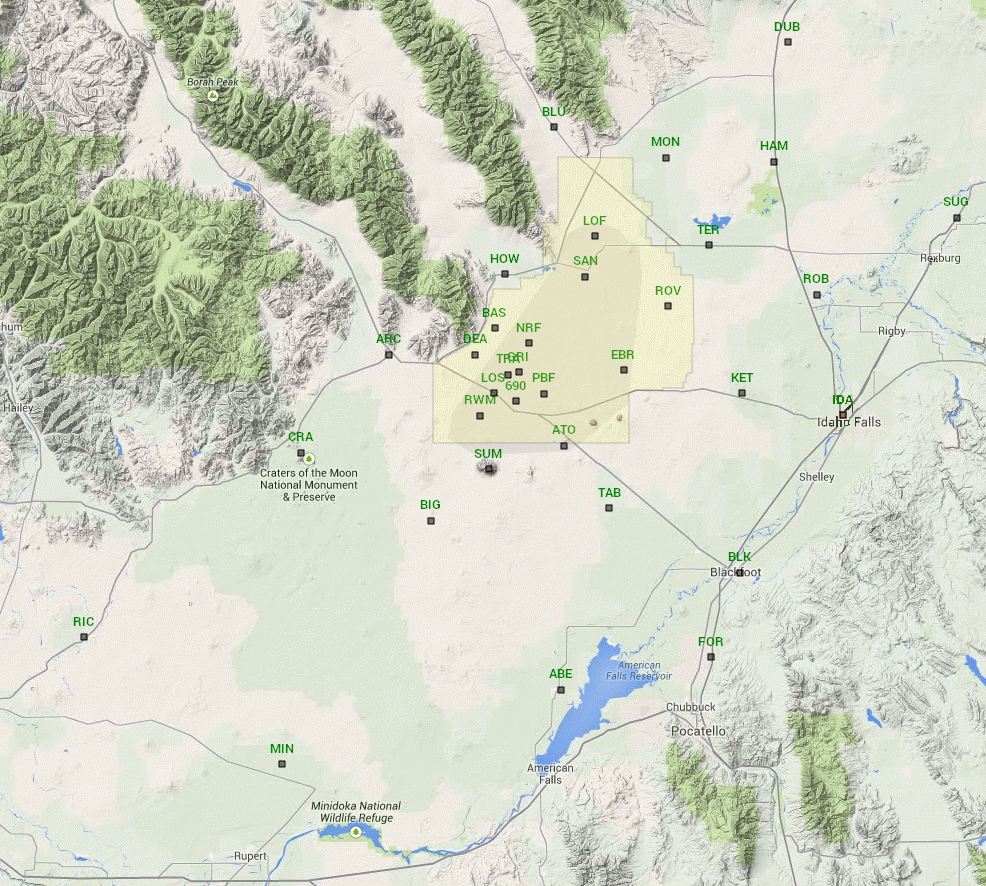
Mesonet locations in the Idaho National Laboratory region.
Over the years, ARL has installed and operated numerous mesonets in support of various tracer and other meteorological studies. Perhaps one of the most extensive mesonets installed was the 43-station mesonet for the San Joaquin Valley Air Quality Study. Smaller mesonets were installed for the Utah County Carbon Monoxide Study and the Central California Ozone Study.
Emergency Response and Meteorological Notices
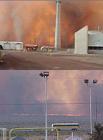
SORD-ID provides a wide range of emergency and advisory forecasts for INL. Over time, emergency response has become more formalized, and the types of meteorological information that are available to support emergency operations has become more sophisticated. ARL meteorologists now staff the DOE Emergency Operations Center (EOC) during drills and emergencies, such as the devastating INL range fires of the late 1990’s. Some of the products and services provided to DOE, contractor, and State of Idaho decision-makers are:
- Wind, temperature, and stability forecasts;
- Transport and diffusion model interpretations;
- Plume trajectories;
- Advice on evacuation routes;
- Prediction of ground level air concentrations;
- Estimates of doses.
Additional services are provided for the safety and efficiency of the numerous construction, industrial, and transportation activities at the INL. These activities require design, planning, and operational support. For example, meteorological notices are routinely prepared for:
- Winds that exceed specific speeds and/or directions, which may be used to warn about blowing dust or unsafe crane operations. Blowing dust, for example, may reduce visibility (a transportation risk), HVAC efficiency (resulting in increased filter cleaning), and increase risk to employees working outdoors.
- Snowfall exceeding 2 inches (important for snow removal scheduling, transportation scheduling, office closings, etc.).
Idaho Environmental Monitoring Program
Public Access Weather Stations
Historically the public has had little access to weather information generated at the INL. Real-time access to such measurements has been primarily reserved for routine operations and emergency response needs. However, with the recognition that scientific information collected for INL operations could be of great value to educational programs and the general public, the Idaho Environmental Monitoring Program (IEMP) was created. ARL, the State of Idaho INL Oversight Program, the INL, and the Shoshone-Bannock Tribes jointly support the IEMP with the installation of four weather stations at publicly accessible locations in southeastern Idaho.
Station Description
These stations are located in Idaho Falls on the Snake River Greenbelt south of the John’s Hole Bridge; in Fort Hall off Interstate-15 by exit 80 in the museum parking lot; at the Big Lost River Rest Area on U. S. Highway 20/26 between Arco and Idaho Falls; and northeast of the INL in Terreton across from the West Jefferson County Fairgrounds.
Each station is comprised of a 50 foot aluminum tower and a kiosk that contains real-time meteorological displays and posters. Various meteorological and environmental sensors are mounted on each tower. Meteorological data collected includes:
- wind speed and direction
- ambient air temperature
- atmospheric moisture
- solar radiation
- precipitation
- barometric pressure
An air sampler that operates continuously collects particles suspended in the air, or particulate matter (PM). Once a week, a filter that collects and retains PM is removed from the sampler and exchanged with a new filter. The used filter is sent to a laboratory where it is analyzed for the total amount of radioactive PM that is acquired by the air sampler. A secondary high-volume air sampler is located at each monitoring site. The high volume air sampler can be activated remotely in the unlikely event that an accidental release occurs at an INL facility. Unlike the primary air sampler, this instrument has the ability to detect low-level radioactivity in a short period of time by drawing in large quantities of air quickly. These samplers are used to evaluate the air quality from natural (background) sources and any man-made sources.
Gamma radiation is measured using a pressurized ionization chamber (PIC). The PIC is capable of measuring background levels of radiation in the environment as well as additional contributions from man-made activities. The units for the measurement of gamma radiation are micro-Roentgens per hour or the number of ionizations that occur during one hour.
Data from all instruments is collected in a data logger located at the tower base. These data are transmitted through a radio telemetry link to the SORD-ID office every five minutes. Various quality control algorithms are employed on these data to ensure sensor reliability and then are permanently archived. These data are then available for redistribution and analysis.
The public can view real-time data from these instruments in the open-air kiosks that are located at each station. Informational displays in the kiosks explain the function of the various instruments and highlight specific topics about a particular measurement that is made at each station. Each kiosk displays weekly and monthly weather conditions; and the roles of the participating agencies that monitor the environment on and around the INL are also explained.
About a year after the initial construction of the four IEMP stations, the data was made available in near real-time via the Internet. Users can access the latest five minute values of the parameters from any of the four IEMP stations. The highest traffic is during the weekdays when people are commuting to and from work. In addition, use of the website increases during episodes of severe weather conditions. For southeastern Idaho, this usually means extreme cold, snowstorms, and/or high winds.

